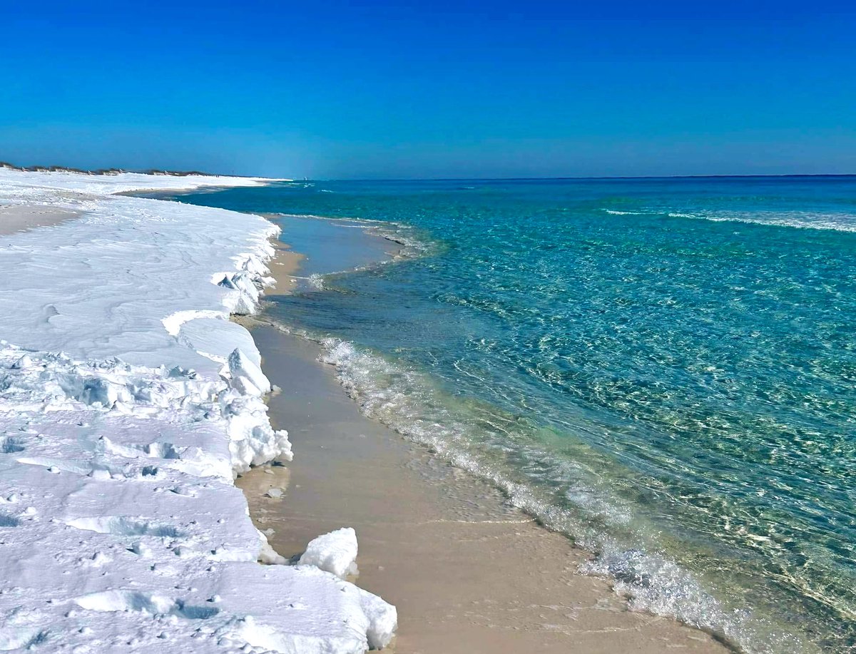
Old man winter is keeping its frosty grip on Florida, at least for a few more days.
In fact, some parts of Florida have been colder and snowier than Anchorage, Alaska.
In Jacksonville, temperatures were consecutively below 40 degrees for a 42-hour stretch. That was the fifth-longest stretch on record at Jacksonville International Airport (since 1971).

Saturday morning looks to be the coldest day of the week, and perhaps for the season, before a gradual warmup begins to take place after that.
In the central part of the State, temperatures are roughly 15 degrees below normal. The average temperature this time of year in Tampa is 62 degrees. The temperature on Thursday afternoon was 47.
In the Tampa Bay forecast region, wind chills could dip as low as 22 degrees, prompting the National Weather Service to warn about cold weather-related concerns like hypothermia. Cold weather advisories with wind chills in the lower 20s extend over to east central Florida as well.
In South Florida, temperatures have been trending a few degrees colder than originally forecast. Low temperatures for the next few nights will be in the upper 30s to low 40s with wind chills possible near freezing on Saturday morning. Temperatures in the afternoon will stay unseasonable cool, in the lower to mid 60s.
Many parts of the state face abnormally low temperatures in the wake of the historic winter storm that dumped record snow in the Panhandle earlier this week.
Although much of the U.S. is inching toward more normal temperatures, the cold has held on in Florida. Another push of reinforcing cold air should usher in even colder overnight temperatures Friday night.

There is a freeze watch as far south as Southwest Florida until Saturday morning.
Frost will be likely if the winds remain light enough and the dew point depression is small enough. But there is still some uncertainty about how far south the frost reaches. Regardless, cold weather advisories go as far south as Fort Myers.

Looking ahead to next week, a high pressure ridge will dip south over Florida bringing an east to southeast wind flow, along with warmer temperatures.
Old man winter is keeping its grip on Florida, at least for a few more days.
In fact, some parts of Florida have been colder and snowier than Anchorage, Alaska.
In Jacksonville, temperatures were consecutively below 40 degrees for a 42-hour stretch. This is the fifth-longest stretch on record at Jacksonville International Airport (since 1971).

Saturday morning looks to be the coldest day of the week, and perhaps for the season, before a gradual warmup begins to take place after that.
In the central part of the State, temperatures are roughly 15 degrees below normal. The average temperature this time of year in Tampa is 62 degrees. The temperature on Thursday afternoon was 47.
In the Tampa Bay forecast region, wind chills could dip as low as 22 degrees, prompting the National Weather Service to warn about cold weather-related concerns like hypothermia. Cold weather advisories with wind chills in the lower 20s extend over to east central Florida as well.
In South Florida, temperatures have been trending a few degrees colder than originally forecast. Low temperatures for the next few nights will be in the upper 30s to low 40s with wind chills possible near freezing on Saturday morning. Temperatures in the afternoon will stay unseasonable cool, in the lower to mid 60s.
Many parts of the state face abnormally low temperatures in the wake of the historic winter storm that dumped record snow in the Panhandle earlier this week.
Although much of the U.S. is inching toward more normal temperatures, the cold has held on in Florida. Another push of reinforcing cold air should usher in even colder overnight temperatures Friday night.

There is a freeze watch as far south as Southwest Florida until Saturday morning.
Frost will be likely if the winds remain light enough and the dew point depression is small enough. But there is still some uncertainty about how far south the frost reaches. Regardless, cold weather advisories go as far south as Fort Myers.

Looking ahead to next week, a high pressure ridge will dip south over Florida bringing an east to southeast wind flow, along with warmer temperatures.

According to the eight- to 14-day temperature outlook from the NWS Climate Prediction Center, all of Florida is expecting above-normal temperatures for the next two weeks.


