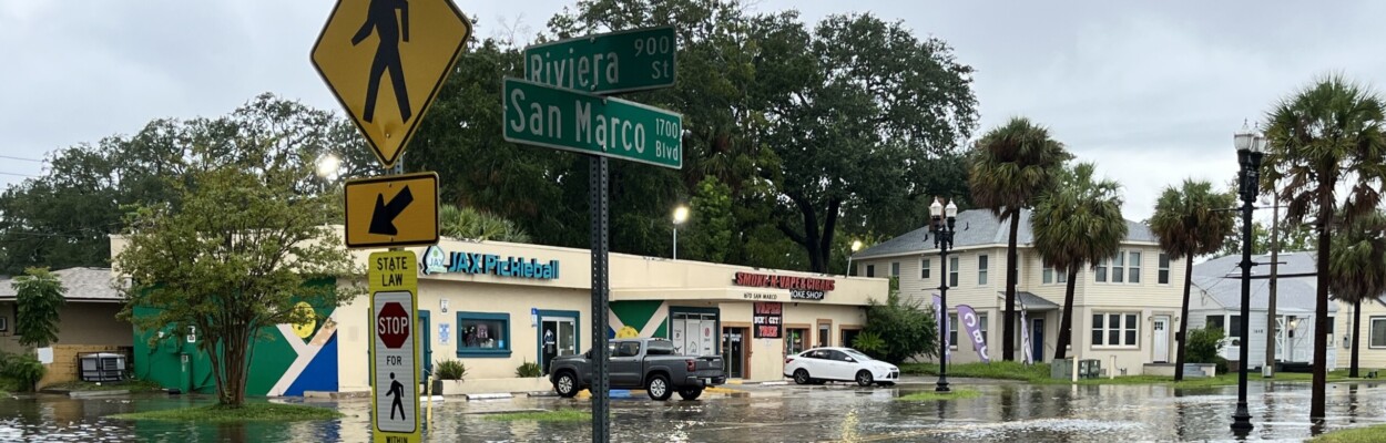
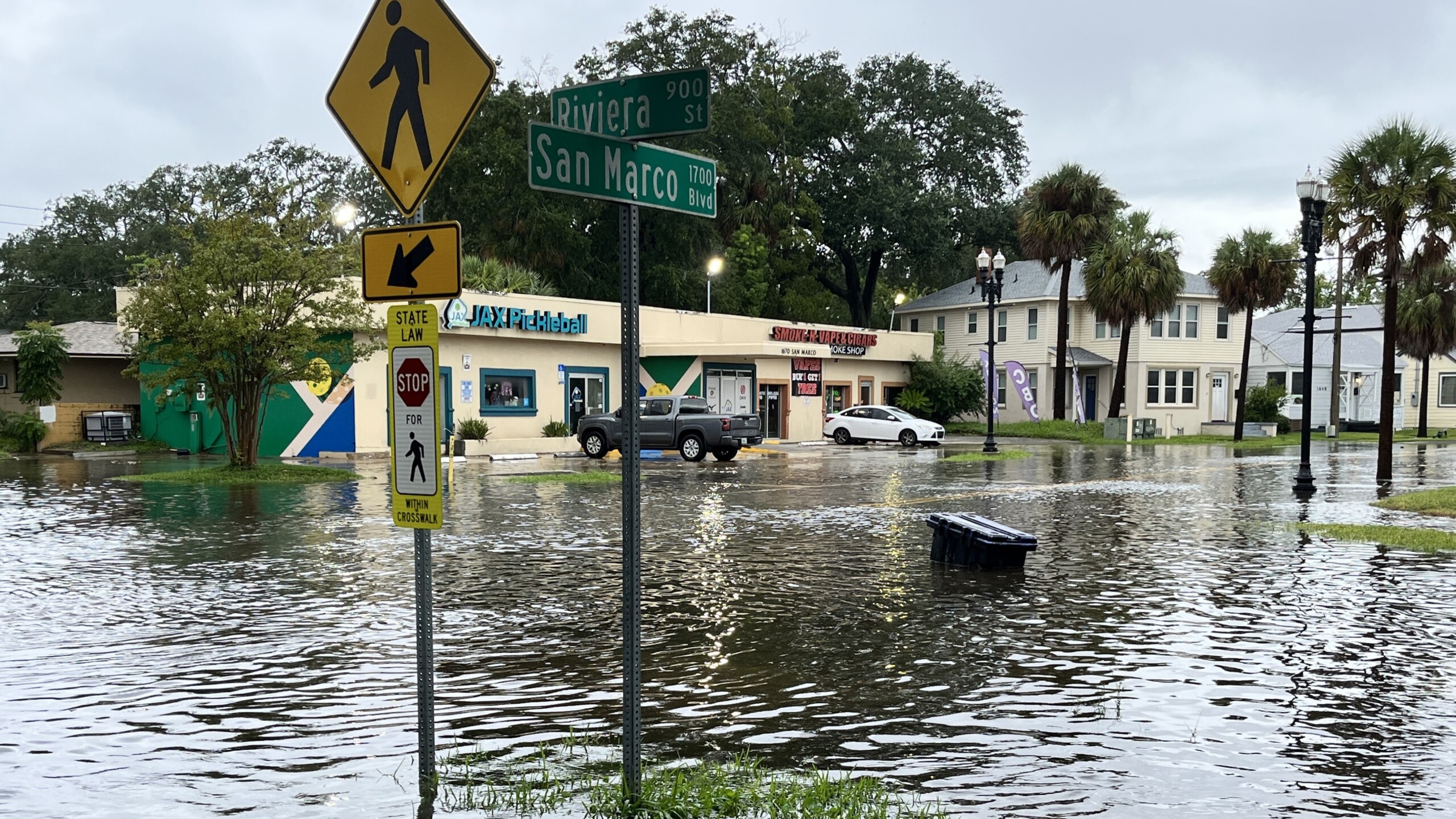
Flooding swamped the San Marco area this week. | Noah Hertz, Jacksonville Today
Published on September 5, 2024 at 4:53 pm
Free local news and info, in your inbox at 6 a.m. M-F. Sign up for the Jacksonville Today newsletter.
Bands of heavy rain could bring additional flooding in soggy Jacksonville over the next several days.
Areas like San Marco, Riverside and the Railyard District near Downtown will be prone to flooding, says Al Sandrick of the National Weather Service office in Jacksonville.
Jacksonville Today thanks our sponsors. Become one.
“You know we see a lot of cars getting stuck in these locations and people stranded and have to be pushed out,” Sandrick said. “Don’t take a chance. Don’t try to drive into flooded areas,”
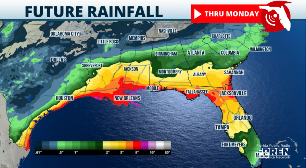
The National Weather Service reports that most of the rainfall since Tuesday has been near Downtown Jacksonville south along the Interstate 95 corridor. Generally, between 5 to 9 inches of rain has fallen in that area since Tuesday.
Flooded businesses
High water affected businesses along San Marco Boulevard, including some near the Lasalle Street drainage project, which is installing a new pump station and overhauling the drainage system.


Jacksonville Today thanks our sponsors. Become one.
The White Magnolia wedding shop says it had water come in the front door, but it caused no damage.
The Row House exercise studio next door received about 2 inches of water where the door was. Owners said the water level, plus the waves created by people driving by, made this the worst flooding they have seen in three years in business.
Meteorologist Megan Borowski from the Florida Public Radio Emergency Network says the atmosphere is primed to produce heavy rainfall over the next few days.
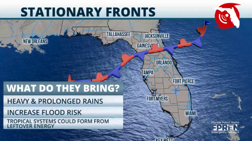
A front has stalled overhead, and winds from the Caribbean have brought in ample tropical moisture, she said.
Stalled fronts interact with the warm and moist environment, producing more shower and storm activity, often at all hours of the day, intermittently. Stalled fronts tend to drastically increase the threat of flash floods, more so if we’ve had a wet summer already.
The coming weekend
Storms across the Panhandle and Florida peninsula could produce several inches of rain each day, Borowski said.
“Then overnight Friday into Saturday, low pressure is poised to track over the Panhandle and North Florida, bringing another risk for heavy rain over those areas,” Borowski said. “And as storms continue to impact the same areas over the next few days into the weekend, flash flooding is going to become a more widespread concern.”
Meteorologist Leslie Hudson from FPREN said slow-moving storms for the next several days could increase the flood risk in already waterlogged areas.
“Florida’s First Coast has had a very busy rainy season, and an area of low pressure off Florida and Georgia will only enhance rain chances,” Hudson said. “Any additional accumulations over the next few days will likely overwhelm drainage areas, creeks, and streams.”