Published on August 2, 2024 at 12:10 pm
Free local news and info, in your inbox at 6 a.m. M-F. Sign up for the Jacksonville Today newsletter.
Gov. Ron DeSantis has issued a state of emergency in Northeast Florida and across much of the state as a tropical system appears almost certain to develop.
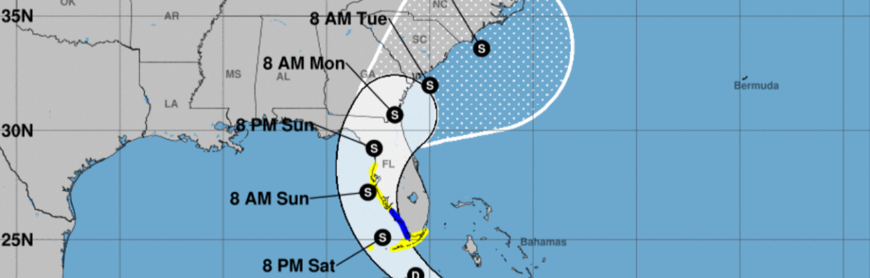
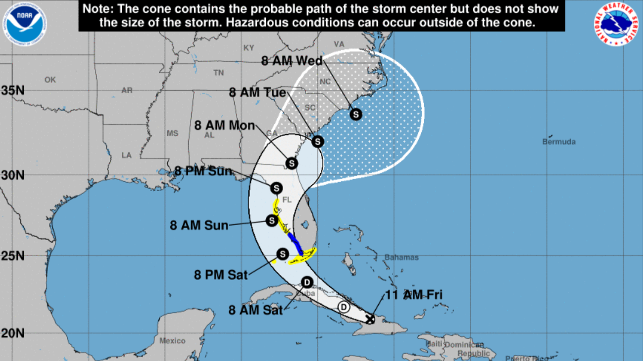
The National Hurricane Center said Friday morning that a tropical wave has a 90% chance of developing into at least a tropical depression over the next seven days. Most models show it moving into the Gulf of Mexico and then coming ashore and crossing the state, possibly moving over Northeast Florida.
Jacksonville Today thanks our sponsors. Become one.
The Hurricane Center issued a tropical storm warning in Southwest Florida and a tropical storm watch in the Keys and north through the Tampa Bay area.
The tropical wave, labeled Potential Tropical Cyclone Four, was producing showers and thunderstorms Friday morning over eastern Cuba, Hispaniola and the southeastern Bahamas. It was expected to move near or over Cuba during the day and then emerge over the Straits of Florida on Friday night or Saturday. A tropical depression is likely to form over the weekend, the Hurricane Center said.
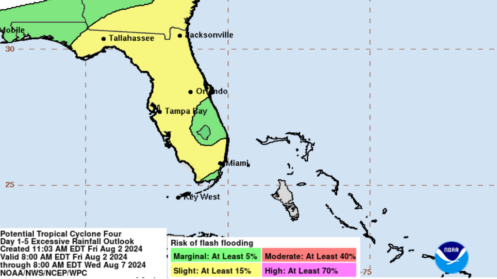
Heavy rains could cause flash flooding across Florida, Cuba and the Bahamas through the weekend, forecasters said. A flash flood risk of at least 15% was forecast in Northeast Florida over the next five days.


Jacksonville Today thanks our sponsors. Become one.
Exactly where the storm will travel and how strong it will become is uncertain because the system remains disorganized. If winds reach 39 mph, it will be named Tropical Storm Debby.
“The environment over the Gulf of Mexico is quite favorable for strengthening with light shear and very warm sea-surface temperatures, so subsequent steady strengthening is expected,” the Hurricane Center said in an 11 a.m. update.
A turn toward the northwest and north is expected during the next couple of days, the Hurricane Center said. The storm then is expected to cross Northern Florida toward the Atlantic Ocean.
“Since the forecast track is almost parallel to the west coast of the Florida Peninsula and the southeast coast of the U. S., only a small change in the track could lead to large changes in which land areas receive any landfalls and the biggest impacts,” the Hurricane Center said.
DeSantis declared a state of emergency in 54 of Florida’s 67 counties, including Duval County and all of Northeast Florida.
Meteorologist Megan Borowski from the Florida Public Radio Emergency Network said the storm system could move slowly. “I say that because this — at least as of this morning — will likely be a heavy rain and flood event for Florida’s Gulf Coast as opposed to a wind event,” she said.
The National Weather Service in Tampa Bay predicted 6 to 8 inches of rain in west central and Southwest Florida.
Borowski said the forecast will likely fluctuate over the next few days and it is important to check for updates. She reminded everyone to double check their emergency kits and review their emergency plans.

Randy comes to Jacksonville from the South Florida Sun-Sentinel, where as metro editor, he led investigative coverage of the Parkland school shooting that won the 2019 Pulitzer Prize for public service. He has spent more than 40 years in reporting and editing positions in Illinois, Iowa, Missouri, Ohio and Florida.