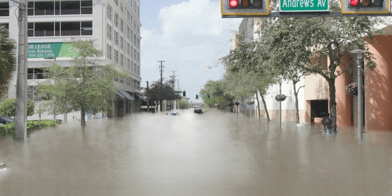
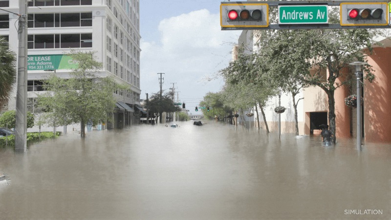
An illustration simulates the effect of rising waters on a city street. The city is not identified, but it's not Jacksonville. | FloodVision
Published on September 13, 2023 at 4:06 pm
Free local news and info, in your inbox at 6 a.m. M-F. Sign up for the Jacksonville Today newsletter.
A nonprofit group is creating dramatic illustrations to show how rising sea levels could endanger well-known landmarks — including EverBank Stadium, the Cummer Museum of Art & Gardens and the Jacksonville Zoo and Gardens.
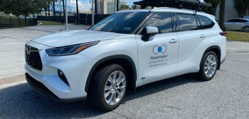
Climate Central stopped in Jacksonville on Wednesday as part of multistate project. Dan Krueger, a technical field producer, said the project is like Google Street View with a lot more technology.
Jacksonville Today thanks our sponsors. Become one.
The group shoots images with a technology called Lidar, which uses light from a pulsed laser to measure distances on Earth. GPS is used to provide the elevation of any point, and the data is overlaid with images to create the simulations.
Ultimately, FloodVision creates images of recognizable locations that can help the public visualize the flooding threats from hurricanes or climate change.
“If, for instance, a hurricane was coming towards Jacksonville, and certain water levels were expected, we could very quickly create those visualizations to help meteorologists and resiliency government officials inform the public,” Krueger said.
Jacksonville Today thanks our sponsors. Become one.
Jacksonville Today reached out to the city of Jacksonville to see if officials plan to use the images from FloodVison. No one immediately responded.
Among the locations Krueger visited were Friendship Fountain, Riverfront Plaza and Everbank Stadium. He also visited the Cummer Museum, the Riverside/Avondale area and the Jacksonville zoo.
Jacksonville isn’t the only stop for Krueger in Florida. He plans to visit St. Augustine, Daytona Beach, Orlando, Tampa, Clearwater, St. Petersburg, Sarasota, West Palm Beach and Fort Lauderdale.
The FloodVision project has been a work in progress for three years, Krueger said. The project was born out of viral photos online of future water levels due to sea level rise, and he says the group saw the influence those photos had on the public.
The idea was off and running.
So far, FloodVison has collected data around New Jersey, Virginia, South Carolina, Georgia and Florida. Moving forward, the project is putting together a trip that would map the whole coastline from Maine to Texas.
Lead image: An illustration simulates the effect of rising waters on a city street. The city is not identified, but it’s not Jacksonville. | FloodVision