Published on August 23, 2023 at 9:55 am
Free local news and info, in your inbox at 6 a.m. M-F. Sign up for the Jacksonville Today newsletter.
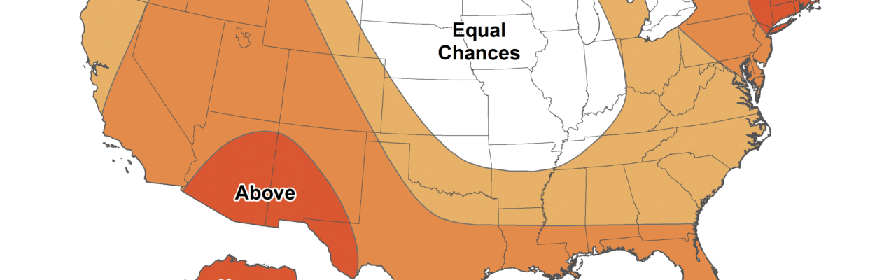
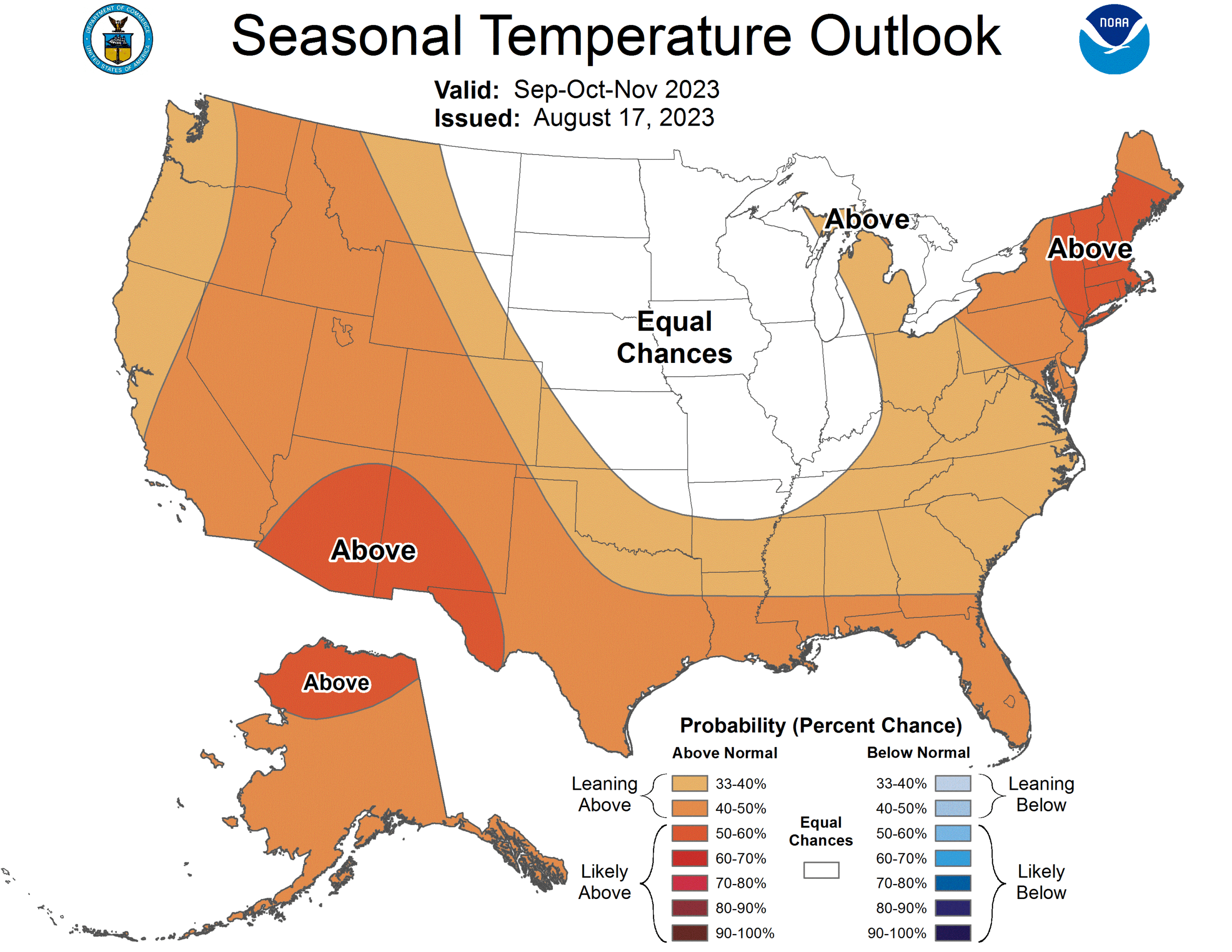
After several locations in Florida recorded their warmest month on record in July, the Southeast Regional Climate Center is predicting that more records may be broken again this month.
Warm water temperatures in the Gulf of Mexico have contributed to high humidity and what feels-like triple digit temperatures.
Jacksonville Today thanks our sponsors. Become one.
NOAA Climatologist Chris Fuhrmann said the Southeast region is seeing a continuation of warmer weather and is predicting above-average temperatures for the next three months. Key West recently recorded its highest minimum temperature at 88 degrees.
The warmer temperatures and lack of rain presented dryness in the northern Gulf Coast and the Tampa Bay area. Severe and extreme drought is emerging across parts of Hillsborough, Manatee and Sarasota counties. According to the National Integrated Drought Information System, 2.9 million Florida residents are facing drought-like conditions.
In North Florida, where peanuts are often growing, the water demand is high at this time of year.
Jacksonville Today thanks our sponsors. Become one.
“Showing over the last couple of weeks is a relatively dry pattern, so that could potentially impact peanuts and other crops across the region moving forward,” Fuhrmann said.
Rain predicted for the next week could improve those conditions.
As the region approaches the peak period for tropical activity, systems can change potential flood risks. Over the three-month forecast, river flood risk remains typical for the Southeast region.
Above-average precipitation is predicted for all the Southeast. North Florida could see, in some cases, half an inch to an inch of rain over the next week or so.
The Climate Prediction Center indicates a 2-in-3 chance of a strong El Niño event by this winter, possibly bringing wetter conditions to the Southeast. This is based on observed sea surface temperatures.
However, stronger impacts are not always a guarantee of significant effects locally, so be sure to stay update throughout the season.
Copyright 2023 Storm Center. To see more, visit Storm Center.9(MDEwNzczMDA2MDEzNTg3ODA1MTAzZjYxNg004))